Skráning frá grunni
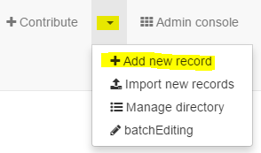
Hægt er velja form/sniðmát til að skrá lýsigögn frá grunni. Þegar búið er að skrá sig inn í Geonetwork er smellt á píluna við hliðina á Contribute og Add new record valið:

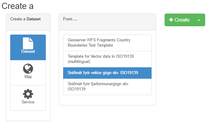
Rétta formið er valið, t.d. Sniðmát fyrir vektor gögn skv. ISO 19139, eins og í þessu tilfelli. Síðan er smellt á Create (plúsinn) og formið opnast.

Athugið að velja form eftir því hvort skráð eru lýsigögn fyrir gagnasett (dataset), kort (map) eða þjónustu (service).

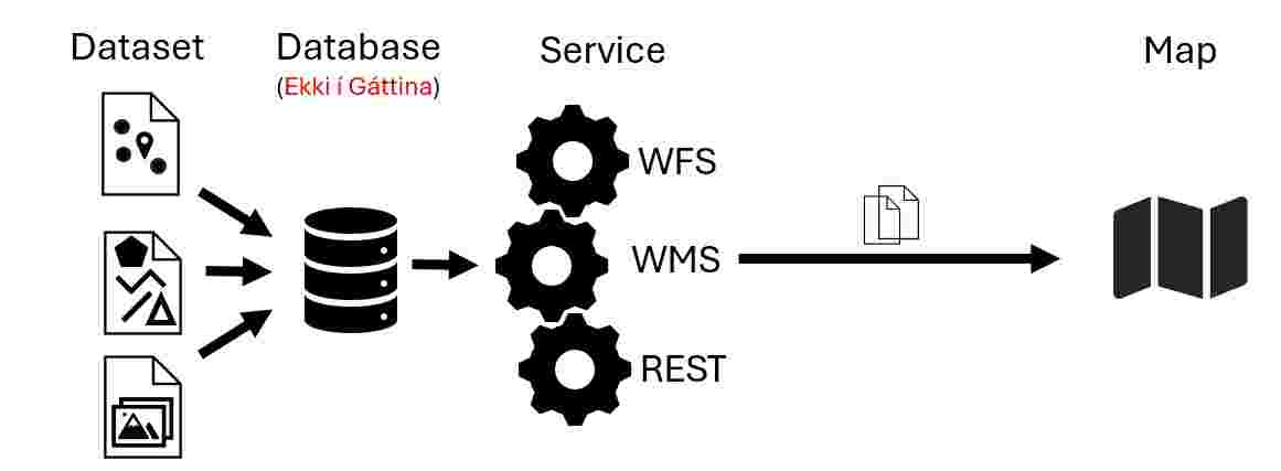
Dataset: A dataset is a collection of points, lines, polygons or rasters. Often a shapefile, geopackage or geotiff are a dataset that is uploaded to a server. In the metadata of the dataset a link to the specific dataset might be given.
Service: A service provides access to a database collecting multiple datasets. Examples of services are WFS, WMS, Rest, ... In the metadata of the service a link to the specific service is provided. The link directs to the database or server where all the datasets are stored.
Map: A map is a printed, digital or interactive representation of datasets on a background. When digital and interactive often the datasets are served to the map thanks to a service. In the metadata of the map a link to the map should be provided.
Til baka í Lýsigagnagátt